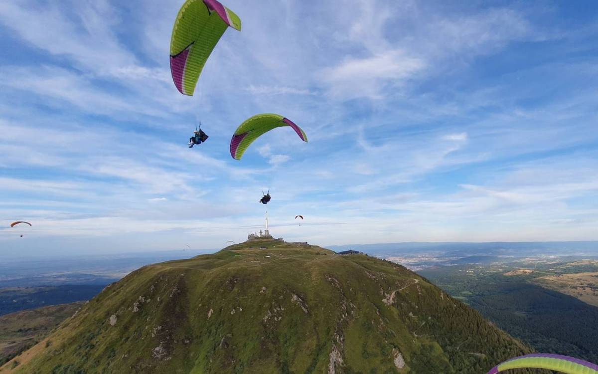
Puy de Dôme is a dormant Pelean volcano in the Massif Central in the Auvergne region of France. It is located about 15 km west of Clermont-Ferrand and reaches a height of 1,465 metres. It is in fact an ancient volcano that formed only 11,000 years ago, making it one of the youngest volcanoes in the Chaîne des Puys. It is classified as a Grand Site de France and a UNESCO World Heritage Site since 2 July 2018. It is possible to climb to the summit thanks to the panoramic train but also thanks to two hiking trails for those who prefer walking. The summit offers a panoramic view of the Chaîne des Puys and the city of Clermont-Ferrand.
The summit of the Puy de Dôme reaches an altitude of 1465 metres, excluding the TDF telecommunications antenna, which makes it the highest volcano in the entire Chaîne des Puys. It rests on a huge granite plateau 1000m high, like all the volcanoes in the area. The Puy de Dôme volcano, which is nothing more than an ancient lava dome, rises about 500 metres above this granite plateau.
GPS coordinates of the Puy de Dôme: N 45° 46′ 21″, E 2° 57′ 51"
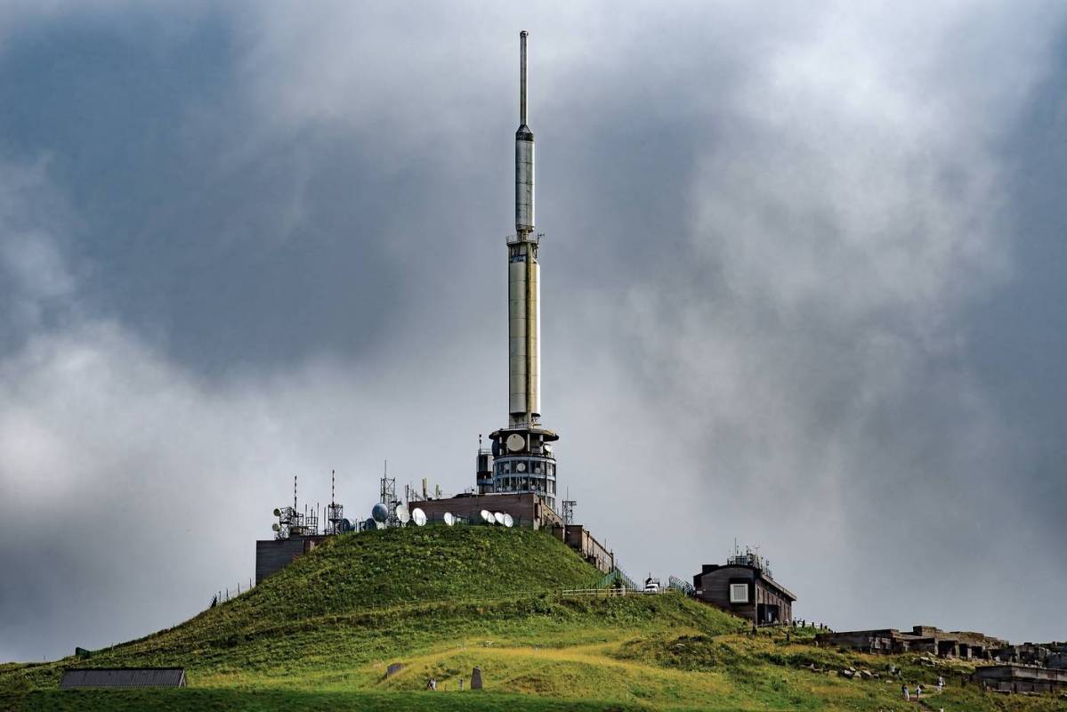
The TDF tower at the top is 73 metres high. If you add this height to the altitude of the volcano you get a height of 1538 metres! A most visible landmark on the horizon for all inhabitants.
To get to the summit you can :
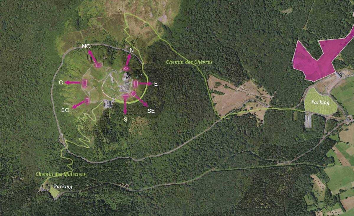
Once on the summit you will have the choice of various activities to do:
The Temple of Mercury is an ancient Roman monument that stood at the top of Puy de Dôme. It was built in the 1st century AD to honour the god Mercury, who was considered the protector of traders and travellers. The temple was a high place of worship and an important crossing point for the Roman trade routes.
Pilgrims arrived there via Agrippa at the Ceyssat Pass and climbed up to the Temple of Mercury.
It is known that the Temple of Mercury was still active until the 4th century, when it was abandoned, probably due to the fall of the Roman Empire. It remained forgotten for centuries until it was rediscovered in the 19th century when an atmospheric observatory was built. Today, there are few visible remains of the Temple of Mercury on the summit of Puy de Dôme, but its existence can be imagined through the archaeological studies carried out on the site. Major restoration work has been carried out to give the building more volume and perspective.
A date to remember for anyone coming to Clermont Ferrand: 19 September 1648. It was on this day that a certain Blaise Pascal, a French mathematician, physicist and philosopher, had a physical experiment carried out at the top of the Puy de Dôme using a barometer compared to a standard barometer that remained in Clermont Ferrand. On 19 September 1648, he was able to validate his theory thanks to a drop in pressure at the top of the mountain. The notion of atmospheric pressure was born!
Pascal's experiments on the Puy de Dôme led to important discoveries in the field of physics and contributed to the understanding of atmospheric pressure and meteorology. It is an example of how scientific experiments can be conducted in unusual places, not just in traditional laboratories.
Since Blaise Pascal's experiment, the Puy de Dôme has become a meteorological observation centre. The first observatory was built in July 1976. It was the very first mountain weather observation laboratory in France! Today, this laboratory continues to exist thanks to the Observatoire de Physique du Globe de Clermont-Ferrand (OPGC) of the Blaise Pascal University of Auvergne, which continues to carry out real-time measurements of meteorology and air quality.
To encourage the development of aviation, the Michelin brothers, Edouard and André, had the idea in 1908 of launching the Michelin Prize, a reward of 100,000 gold francs for any pilot who managed to take off from Paris and land in an aeroplane at the top of the Puy de Dôme. It was not until 7 March 1911 that Eugène Renaux succeeded in this feat, beating the distance record for an aeroplane at the time. When you see the topography of the summit of the Puy de Dôme, you realise how difficult it was to fly at the time with more than rudimentary machines.
If an old train with central rail existed and circulated from 1907 to 1926 from the centre of Clermont Ferrand to the summit, it was then completely abandoned to be replaced by a road. From 1926 this toll road replaced the train and remained in service until the 2010s. It was then replaced by the Panoramique des Dômes project, a modern rack railway financed by the Conseil Général du Puy de Dôme. The choice was made for a Swiss-made train (Stadler-Rail) and an infrastructure provided by the Canadian company SNC-Lavalin. Heavy work was necessary to accommodate the train's single track and the side emergency track around the volcano. A crossing area with a switch is also planned at the intersection with the Chemin des Muletiers so that two trains can run in opposite directions during busy periods.
The inauguration of the new Puy de Dôme rack railway will take place in June 2012.
The cogwheel train departs from the Taillerie station in Orcines, at the foot of the Puy de Dôme.
GPS coordinates of the Panoramique des Dômes station: N 45° 46' 21" E 02° 59' 15"
To get to the station you will need to take either the car from Clermont-Ferrand or the A89 or the bus from the town centre and the Place du 1er Mai. Be careful with the bus timetable for the return journey so that you don't end up having to hitchhike at the end of the day.
Widely indicated from all directions, you can't miss the departure station.
Find all the 2023 timetables of the Puy de Dôme rack train : the Panoramique des Dômes : frequency, ascent time and descent time from January to December.
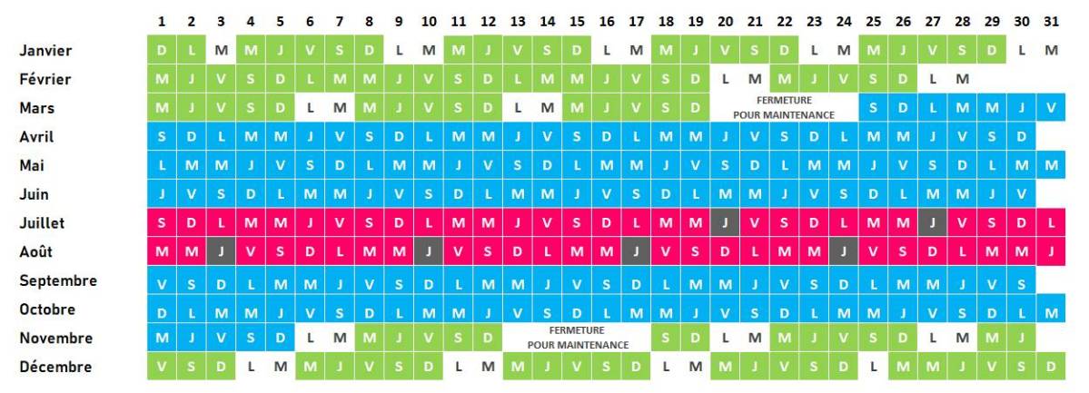
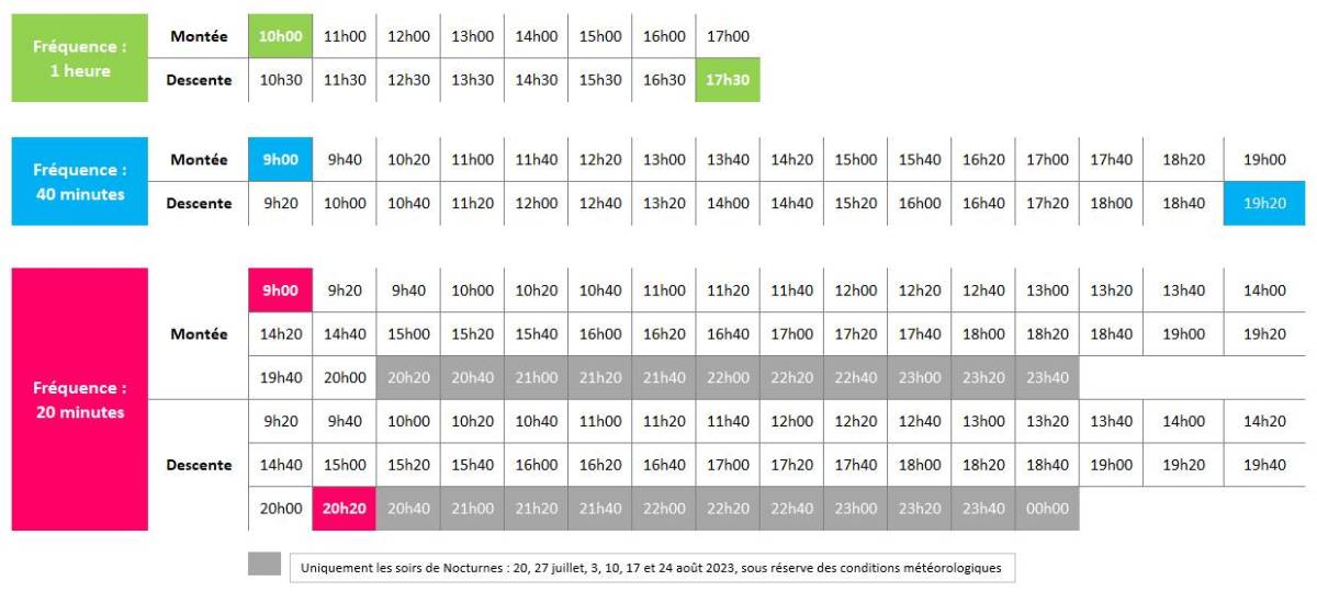
Attention: these provisional schedules are communicated by Freedom Parapente as an indication, they can be modified if necessary at the last moment by the operator of the Panoramique des Dômes.
Parking is very easy at the Panoramique des Dôme station as large free car parks have been provided to accommodate the many visitors. There is also a motorhome area and public toilets.
There is also free parking at the Col de Ceyssat at the start of the Chemin des Muletiers.
In order to be sure to take advantage of the best possible conditions to discover the Puy de Dôme, we put at your disposal a page dedicated to the weather at the summit as well as a page regrouping all the interesting webcams. You will be able to get an idea of the conditions that prevail up there and thus easily adapt your clothing because be careful in Auvergne it can be cold!
Yes, it is quite possible to eat at the top of the Puy de Dôme. You will find 3 different restaurants: the Resto d'Epicure and its Bistronomic concept (a bistro-gastro-panoramic), the Table d'Epicure, more self-service oriented and the Buron d'Epicure where you can find a large choice of sandwiches and other snacks.
You will also find a picnic room at the foot of the antenna where you can take shelter in case of bad weather to enjoy your snack. The picnic room also houses an exhibition on geology which will delight both young and old. This exhibition will allow you to better understand the formation of the numerous volcanoes of the Auvergne.
Every year, the Puy de Dôme is a Mecca for cultural events. Throughout the summer, shows are given at the summit. You can enjoy the sunset and the beautiful animations. The space at the summit is limited, so it is best to book tickets in advance as at certain times it can be difficult to get in. There are major events such as the Nuées Ardentes festival, the Night of the Stars, the Departmental Archaeology Days and many other summer events. You can find all the dates on the events calendar.
In winter, the mountain is covered in ice and snow and you can go ice skating or admire Land Art creations such as Les Portes de Givre during the winter of 2022-2023.
